


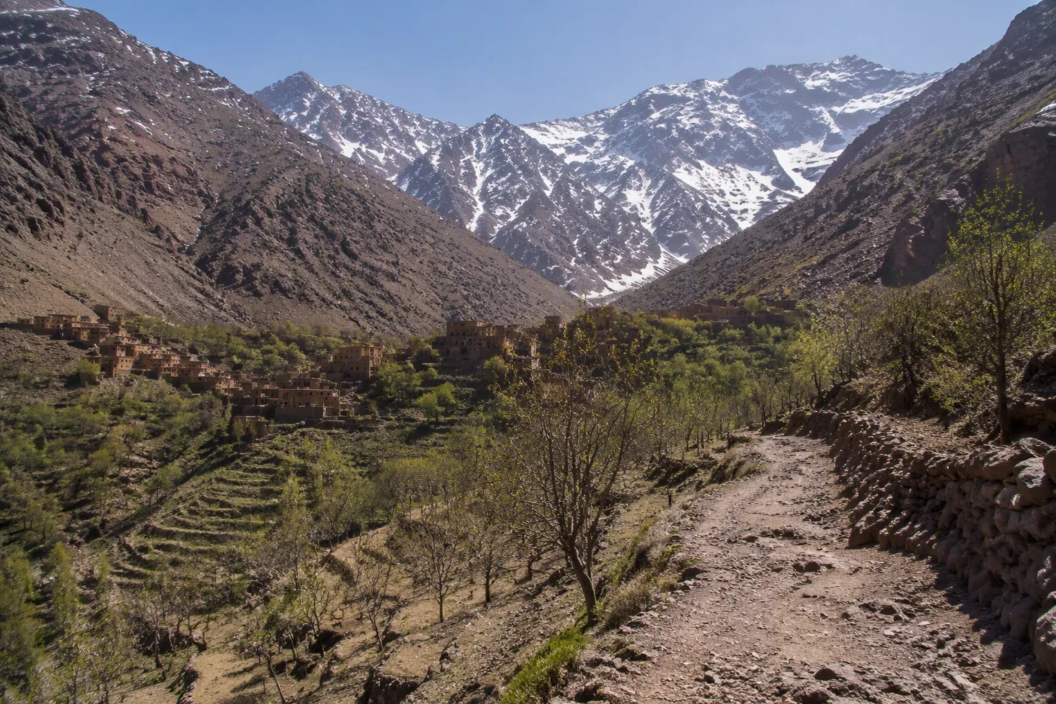
If the day is meant for walking in the mountains, go to Imlil; if it is meant for following a river and having lunch in the cool, take the Ourika Valley. Toubkal fits into neither. It is climbed in two days with a guide, and a day trip only shows you its foot.
These three names come up together on almost every offer leaving Marrakech, sometimes on the same line, as if they made up a single outing. They are three different things, and two questions are enough to decide: how many hours you want to walk, and what the weather will be that day.
Which Atlas excursion should you choose?
Imlil is our preference, including for a first time, as long as two or three hours of walking do not scare you. This is where the Atlas really looks like high mountain country. The village sits at around 1,740 m, at the end of the paved road, and the trails start from the last houses. Allow about 1 h 30 to 2 h by road from Marrakech depending on traffic.
Ourika suits those who want water, shade and less effort, as long as it is not raining. According to the Marrakech-Safi Regional Tourism Council, the valley begins about thirty kilometers south of the city. But Setti Fatma, the village of the waterfalls, lies at the very end, about 65 km and 1 h 30 away by road. The proximity argument you will hear for Ourika therefore only holds if you stop along the way: for the waterfalls, you will spend roughly as much time in the car as for Imlil.
| Imlil | Ourika (Setti Fatma) | Toubkal | |
|---|---|---|---|
| Drive from Marrakech | 1 h 30 to 2 h | about 1 h 30 | starts from Imlil |
| What you do there | walking between villages, lunch on site | river, waterfalls, lunch by the water | climbing a 4,167 m summit |
| Effort | real, on mountain trails | low up to the first waterfall, sustained beyond | two days, sometimes three |
| What can spoil the day | the wrong shoes | a rainy day | believing it can be done in a day |
Other valleys, such as Ouirgane, are also on offer for a slower day, and are chosen on the same two questions.
The day in Imlil
The village matters less than what begins above it: the mule tracks, the terraced hamlets, the walnut trees, and the Toubkal massif closing off the end of the valley. A typical day makes a loop of a few hours between villages, with a tagine eaten in a local home or a mountain lodge.
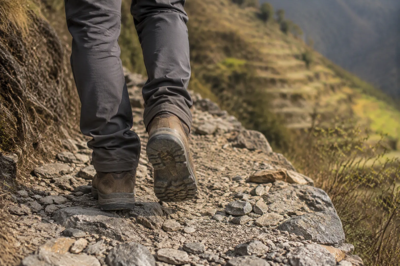
This is also where the wrong outfit costs you. Atlas trails call for real walking shoes as soon as you leave the drivable tracks, and in the villages, covered shoulders and legs covered to mid-calf remain the most comfortable choice, for you and for your exchanges with people there. Our page on what to wear in Marrakech gives the detail season by season, excursions included.
Since 2019, every non-Moroccan hiker must be accompanied by a licensed mountain guide to enter the Toubkal massif, and checks enforce this on the trail, notably after Aremd. A walk between the hamlets around Imlil stays, in principle, short of these checks, but have the route confirmed. As soon as the program mentions going up toward the refuge, make sure the person accompanying you is a licensed guide, and not just the driver.
After the 2023 earthquake
The earthquake of September 8, 2023 struck Al Haouz province, the province of Imlil and Toubkal. Within the two weeks that followed, Imlil’s guides were already clearing the trails that climb to Toubkal so that visitors could return. In late 2024, the Moroccan press described Moroccan and foreign tourists flocking to the village again.
That account from late 2024 remains the most recent we have found, and it does not give the state of every trail. The main trail was reopened very early; a secondary path or a hamlet may still bear traces of the damage.
Ask for the exact route the day before; an Imlil guide will be able to tell you what is passable and what is not.
Ourika, easier on paper
The valley owes its reputation to seven waterfalls stepped above Setti Fatma. The first is reached without difficulty; the next ones call for more sustained effort and suitable shoes. On site, it is common to go with a local guide: for the first waterfall you can do without one, for the next ones it is the more sensible choice.
The real subject here is water. On August 17, 1995, a violent downpour swept away hundreds of people in the valley, and flood detectors have since been installed to warn residents and tourists. A summer storm in the mountains is enough to make a steep-sided river rise very fast, even when the weather is fine in Marrakech. In rainy weather, the waterfall trails turn slippery. Add what the valley has already been through, and a valley floor is not the place to wait for a storm to pass: on a day when rain is forecast, or storms over the summits, keep to Imlil or a day in town. Ourika will wait.
Toubkal does not fit into a day
Toubkal peaks at 4,167 m, the highest point in North Africa, 63 km south of Marrakech. Between Imlil and the summit, you cover nearly 35 km round trip for an elevation change of nearly 5,000 m. The most common format spreads over two days, sometimes three to acclimatize, with a night in one of the refuges at 3,200 m, two or three hours from the summit. At that altitude, altitude sickness cannot be ruled out.
An offer titled “Toubkal” leaving Marrakech and wrapped up in a day is therefore a day in Imlil with a view of the massif. Nothing dishonest in that, provided you pay for it and judge it for what it is. If it is the summit you are after, plan two separate days, a licensed guide, and a stay long enough not to take them out of the rest of Marrakech.
Before you book
Read the program line by line. Ourika is part of the Atlas, and an “Atlas + Ourika” package may well never go up to Imlil. If Imlil is what you want, its name must appear in the program, with the number of hours of walking. Check too whether lunch is included, whether the person accompanying you is a guide or only a driver, and what time you will be picked up.
For an early start, ask your riad whether breakfast is possible from 7 a.m.; it is one of the questions to ask when choosing where to stay in Marrakech for a first visit.
One valley per day.
With 1 h 30 to 2 h of road for Imlil and about 1 h 30 for Setti Fatma, doing two on the same day is mostly car time. In a five-day stay, a single excursion finds its place naturally, as in our selection of what to see in Marrakech.
Shorter, or much longer
Visit Agafay stone desert, about 45 minutes from Marrakech, takes half a day and keeps the Atlas as a backdrop: to see the summits without climbing them, it is the short alternative. The rest, for getting there, is in our guide to the Agafay desert.
The Ouzoud waterfalls, for their part, take about 2 h 30 to 3 h of road each way: a truly long day, which compares with neither Imlil nor Ourika.
To compare the Atlas with Agafay, Essaouira or Ouzoud, the other day trips from Marrakech are reviewed one by one, and the question of going on a private or group excursion has its own page.